Back to the List of Starting Points...
Starting at City Hall (Front Steps)...
  Starting at City Hall (Front Steps): Miles Minutes
  Surfers Point Out and Back 1.44 25-35
  VBG Lower Trail Central Loop 1.46 25-35
  Grant Park West Loop 1.59 27-38
  Grant Park East Loop 1.65 28-40
  Beach/Mission Loop 1.71 29-41
  Pier Out and Back 1.72 29-41
  VBG Lower Trail East Loop 1.85 32-44
  Grant Park Cross West Loop 1.91 33-46
  VBG Lower Trail West Loop 1.92 33-46
  Beach/Sanjon Out and Back 1.95 33-47
  Grant Park Wide Loop 2.11 36-51
  Grant Park Cross East Loop 2.17 37-52
  Grant Park Cross Wide Loop 2.42 41-58
  Ventura River Out and Back 2.44 42-59
  Pier/Beach/Mission Loop 2.58 44-62
  State Beach Out and Back 2.64 45-63
  Beach/Mission/River Loop 2.80 48-67
  Beach/San Pedro Out and Back 3.10 53-74
  Grant Park Double Loop - East/West 3.25 56-78
  Grant Park Double Loop - Wide/West 3.57 61-86
  Grant Park Double Loop - Wide/East 3.63 62-87
  Pier/Beach/Mission/River Loop 3.68 63-88
  Grant Park Triple Loop - Wide/East/West 5.23 90-126

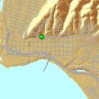
These Walking Routes were modeled using the City of San Buenaventura's Geographic Information System.   Distance measurements are all made without attempting to compensate for vertical gain or loss.   Time calculations are based on average walking rates of 3.5 to 2.5 miles per hour.   Some of the routes travel into the foothills resulting in a more strenuous workout.   For a less strenuous workout, stay on the routes that avoid these foothills.