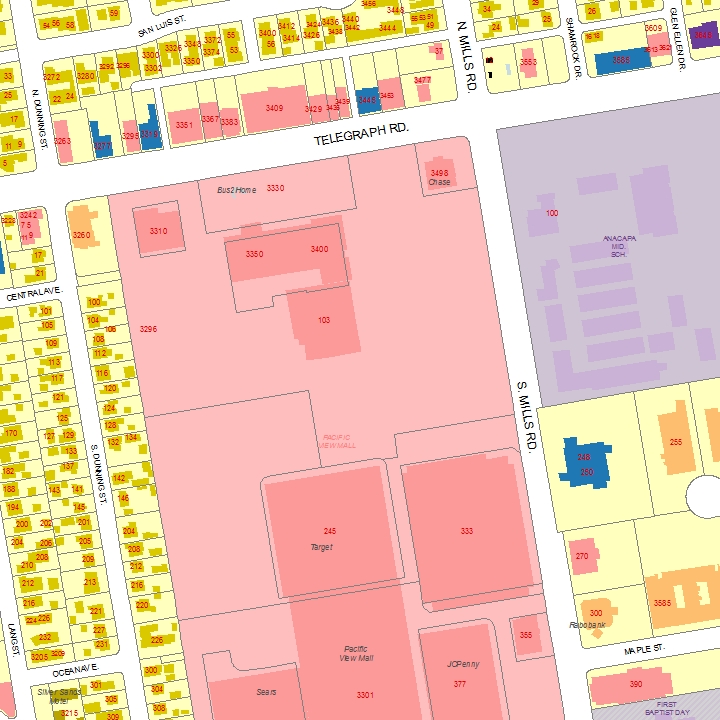
Address:
Zip Code:
Police Beat:
Fire Sector:
Maint. Zone:
Voting District:
Map Grid:
Addr.ID:
Map Coords:
Source:
56 DUNNING ST N #102
93003 (CITY)
Beat: 2 RD:56
Station: City 2 RD: 2009
9
2
14G
41141
X=30159 Y=17914
PO (Post Office Data (2001))
This is a product of the City of San Buenaventura, California, based on the Master Address Coordinate database in the Geographic Information System.
Although reasonable efforts have been made to ensure the accuracy of this document, the City of San Buenaventura cannot guarantee its accuracy.
Parcel Number:
077-0-051-095